
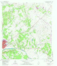
1957 Map of La Grange East
USGS Topo · Published 1958About this map
The Colorado River anchors the southern portion of this Fayette County landscape, where the city of La Grange sits at a strategic bend. In the late 1950s, the town's social and civic infrastructure is clearly visible, including Randolph High School, Hermes School, and the County Hospital. To the north and east, the map reveals a pattern of smaller agrarian settlements like Rutersville, Oldenburg, and Halsted, which are interconnected by the Missouri Kansas Texas railroad line.
Find a feature on this map
42 named features on this map. Tap any name to fly to it.
Don’t see what you’re looking for? This feature index may not catch every label — zoom into the map to look around manually.
Map Details
Editions of this 1957 La Grange East Map
2 editions found
Other maps of this area

1919 · Fayettsville
USGS Topo · 1:62,500

1919 · Giddings
USGS Topo · 1:62,500

1953 · Seguin
USGS Topo · 1:250,000

1954 · Austin
USGS Topo · 1:250,000

1956 · La Grange
USGS Topo · 1:62,500

1957 · Ellinger
USGS Topo · 1:24,000

1957 · Ammannsville
USGS Topo · 1:24,000

1958 · La Grange West
USGS Topo · 1:24,000

1958 · Seguin
USGS Topo · 1:250,000
1958 · Nechanitz
USGS Topo · 1:24,000