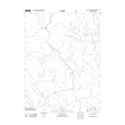
2012 Map of Feliciana Mountain
USGS Topo · Published 2012About this map
Midpines and the surrounding Mariposa County highlands are defined by a complex network of forest roads and creek drainages in this 2012 survey. The Merced River cuts through the northwest corner at Briceburg, while the central terrain is dominated by Feliciana Mountain and Sweetwater Ridge. The map details a transition from the river canyon to the high points at Sweetwater Point, illustrating the modern layout of rural settlements and remote outposts like Timber Lodge, Acorn Lodge, and Mono Camp. Numerous named roads such as Incline Rd, Ponderosa Way, and Buckingham Mountain Rd provide a clear view of the access routes through the southern Sierra Nevada foothills, connecting various drainages including Bear Cr, Saxon Cr, and Stockton Cr.
Find a feature on this map
78 named features on this map. Tap any name to fly to it.
Don’t see what you’re looking for? This feature index may not catch every label — zoom into the map to look around manually.
Map Details
Editions of this 2012 Feliciana Mountain Map
This is the sole edition of this map. No revisions or reprints were ever made.
Other maps of this area

1893 · Sonora
USGS Topo · 1:125,000

1896 · Sonora
USGS Topo · 1:125,000

1897 · Sonora
USGS Topo · 1:125,000

1897 · Yosemite
USGS Topo · 1:125,000

1898 · Sonora
USGS Topo · 1:125,000

1900 · Yosemite
USGS Topo · 1:125,000

1903 · Yosemite
USGS Topo · 1:125,000

1909 · Yosemite
USGS Topo · 1:125,000

1912 · Mariposa
USGS Topo · 1:125,000

1919 · Indian Gulch
USGS Topo · 1:48,000