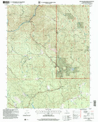
2004 Map of Feliciana Mountain
USGS Topo · Published 2007About this map
Merced River canyons and the gold-bearing ridges of the Sierra National Forest dominate this landscape during the early 21st century. The map centers on the community of Midpines and the transit corridor along the Yosemite All-Year Highway, while also documenting the historical extraction economy that shaped the region. Mining operations are found throughout the steep terrain, including the King Solomon Mine, Feliciana Mine, and Buffalo Mine. Local educational history is preserved through labels for the Colorado Sch and the Historical Bear Creek Sch near Bear Creek. The presence of the Timber Lodge (Site) and scattered prospects near Colorado Canyon illustrates the evolution from early pioneer settlement to modern recreational and forest management use within Mariposa County.
Find a feature on this map
45 named features on this map. Tap any name to fly to it.
Don’t see what you’re looking for? This feature index may not catch every label — zoom into the map to look around manually.
Map Details
Editions of this 2004 Feliciana Mountain Map
This is the sole edition of this map. No revisions or reprints were ever made.
Other maps of this area

1893 · Sonora
USGS Topo · 1:125,000

1896 · Sonora
USGS Topo · 1:125,000

1897 · Sonora
USGS Topo · 1:125,000

1897 · Yosemite
USGS Topo · 1:125,000

1898 · Sonora
USGS Topo · 1:125,000

1900 · Yosemite
USGS Topo · 1:125,000

1903 · Yosemite
USGS Topo · 1:125,000

1909 · Yosemite
USGS Topo · 1:125,000

1912 · Mariposa
USGS Topo · 1:125,000

1919 · Indian Gulch
USGS Topo · 1:48,000