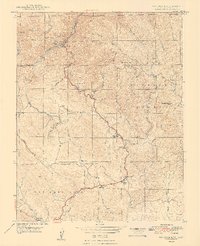
1948 Map of Feliciana Mtn.
USGS Topo · Published 1948About this map
Merced River flows through the northern reaches of this Sierra Nevada landscape, serving as a primary corridor for the Briceburg settlement. The post-war era infrastructure is anchored by the Yosemite All-Year Highway, which snakes through the steep terrain to connect local outposts like Summit Inn, Timber Lodge, and Midpines. This survey captures a transitional period in the local economy, where industrial gold mining legacies are still evident at the King Solomon Mine, Feliciana Mine, and Colorado Mine, yet the presence of the Mariposa Ranger Station and the Sierra National Forest boundary reflects the growing importance of federal land management and tourism. Rural life is further mapped through isolated educational landmarks such as Colorado Sch and Bear Creek Sch, and high points like Feliciana Mtn that command the drainage basins of Bear Creek and Sherlock Creek.
Find a feature on this map
35 named features on this map. Tap any name to fly to it.
Don’t see what you’re looking for? This feature index may not catch every label — zoom into the map to look around manually.
Map Details
Editions of this 1948 Feliciana Mtn. Map
2 editions found
Other maps of this area

1893 · Sonora
USGS Topo · 1:125,000

1896 · Sonora
USGS Topo · 1:125,000

1897 · Sonora
USGS Topo · 1:125,000

1897 · Yosemite
USGS Topo · 1:125,000

1898 · Sonora
USGS Topo · 1:125,000

1900 · Yosemite
USGS Topo · 1:125,000

1903 · Yosemite
USGS Topo · 1:125,000

1909 · Yosemite
USGS Topo · 1:125,000

1912 · Mariposa
USGS Topo · 1:125,000

1919 · Indian Gulch
USGS Topo · 1:48,000