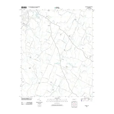
2010 Map of Felker
USGS Topo · Published 2010About this map
Sugar Creek winds through this landscape in Bradley County, anchoring a community marked by a dense concentration of family and community burial grounds. The map reveals the rural layout of the region, where a network of local roads like Trewhitt Rd and Hughes Rd connect established homesteads and small water bodies, including Wildwood Lake, Kile Lake, and Hunt Lake. Prominent terrain features such as Million Hill and the Blackburn Ridges define the local topography, while landmarks like Ramsey Bridge indicate vital crossings. Genealogists will find this particular sheet especially useful for locating numerous small cemeteries, including Liberty Cemetery, Moores Chapel Cemetery, and Samples Memorial Cemetery, many of which are tucked away along secondary routes and near landmarks such as Thompson Springs.
Find a feature on this map
101 named features on this map. Tap any name to fly to it.
Don’t see what you’re looking for? This feature index may not catch every label — zoom into the map to look around manually.
Map Details
Editions of this 2010 Felker Map
This is the sole edition of this map. No revisions or reprints were ever made.
Other maps of this area

1886 · Dalton
USGS Topo · 1:125,000

1886 · Cleveland
USGS Topo · 1:125,000

1892 · Cleveland
USGS Topo · 1:125,000

1892 · Dalton
USGS Topo · 1:125,000

1895 · Cleveland
USGS Topo · 1:125,000

1897 · Dalton
USGS Topo · 1:125,000

1901 · Cleveland
USGS Topo · 1:125,000

1911 · Cohutta Mtn
USGS Topo · 1:62,500

1913 · Cohutta Mtn.
USGS Topo · 1:62,500

1935 · East Cleveland
USGS Topo · 1:24,000