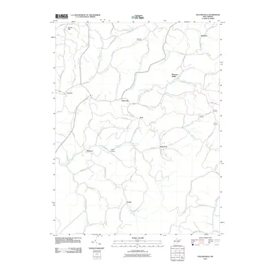
2011 Map of Fellowsville
USGS Topo · Published 2011About this map
Fellowsville serves as a central hub in this Appalachian landscape, where the Left Fork Little Sandy Creek and Right Fork Little Sandy Creek converge. The terrain is defined by its deep drainages and named ridges like Scotch Hill and Shay Hill, which shaped the early road network of Preston County. Local history is etched into the land through family-named thoroughfares such as Aubrey Wolfe road and Pete Shahan road, alongside numerous small settlements including Sinclair, Israel, and Marquess. Genealogists will find several burial sites noted across the hills, from Blackwood Cemetery in the north to the Nazareth and Bolyard cemeteries further east. The map captures the persistent rural character of these West Virginia hollows, where life still follows the paths of Little Sandy Creek and its many tributaries.
Find a feature on this map
70 named features on this map. Tap any name to fly to it.
Don’t see what you’re looking for? This feature index may not catch every label — zoom into the map to look around manually.
Map Details
Editions of this 2011 Fellowsville Map
This is the sole edition of this map. No revisions or reprints were ever made.
Other maps of this area

1886 · St. George
USGS Topo · 1:125,000

1891 · St. George
USGS Topo · 1:125,000

1907 · Thornton
USGS Topo · 1:62,500

1907 · Kingwood
USGS Topo · 1:62,500

1907 · Belington
USGS Topo · 1:62,500

1908 · Parsons
USGS Topo · 1:62,500

1925 · Kingwood
USGS Topo · 1:62,500

1926 · Thornton
USGS Topo · 1:62,500

1926 · Parsons
USGS Topo · 1:62,500

1927 · Belington
USGS Topo · 1:62,500