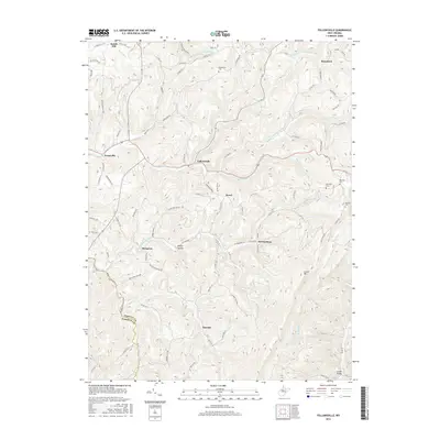
2016 Map of Fellowsville
USGS Topo · Published 2016About this map
The high ridges of Laurel Mtn and the winding course of Sandy Creek define this section of the West Virginia highlands at the boundary between Preston Co and Barbour Co. This 2016 survey documents a landscape of deeply etched stream valleys and scattered upland settlements that have endured for generations. Small communities such as Fellowsville, Sinclair, and Kanetown are connected by a network of rural routes like the Old Evansville Pike and Stevensburg Rd, while the local topography is shaped by the numerous forks of Little Sandy Cr. For those researching regional heritage, the map identifies specific landmarks like Number 16 School and a collection of family-named burial grounds, including Blackwood Cem and Bolyard Cem, which serve as vital points of reference for tracing local lineage in this mountainous terrain.
Find a feature on this map
92 named features on this map. Tap any name to fly to it.
Don’t see what you’re looking for? This feature index may not catch every label — zoom into the map to look around manually.
Map Details
Editions of this 2016 Fellowsville Map
This is the sole edition of this map. No revisions or reprints were ever made.
Other maps of this area

1886 · St. George
USGS Topo · 1:125,000

1891 · St. George
USGS Topo · 1:125,000

1907 · Thornton
USGS Topo · 1:62,500

1907 · Kingwood
USGS Topo · 1:62,500

1907 · Belington
USGS Topo · 1:62,500

1908 · Parsons
USGS Topo · 1:62,500

1925 · Kingwood
USGS Topo · 1:62,500

1926 · Thornton
USGS Topo · 1:62,500

1926 · Parsons
USGS Topo · 1:62,500

1927 · Belington
USGS Topo · 1:62,500