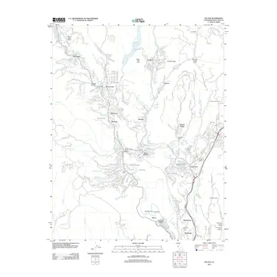
2012 Map of Felton
USGS Topo · Published 2012About this map
Felton and its neighboring communities in the Santa Cruz Mountains are defined by a complex network of canyons and gulches, through which the San Lorenzo River flows south. This 2012 survey details a landscape where traditional landmarks like the Felton Covered Bridge and Branciforte Covered Bridge coexist with significant recreation and tourism sites. The map documents the presence of Roaring Camp and its Roaring Camp Depot, reflecting the area's long association with narrow-gauge rail history. Further east, Scotts Valley and Camp Evers mark the more developed corridor, while the north is punctuated by Loch Lomond and Eagle Dell Peak. This edition captures the specific spatial relationships between residential enclaves like Ben Lomond, Brookdale, and Lompico, and local institutions such as the Christian Conference Grounds and the iconic roadside attraction, The Mystery Spot.
Find a feature on this map
68 named features on this map. Tap any name to fly to it.
Don’t see what you’re looking for? This feature index may not catch every label — zoom into the map to look around manually.
Map Details
Editions of this 2012 Felton Map
This is the sole edition of this map. No revisions or reprints were ever made.
Other maps of this area

1902 · Santa Cruz
USGS Topo · 1:125,000

1912 · Capitola
USGS Topo · 1:62,500

1914 · Capitola
USGS Topo · 1:62,500

1916 · New Almaden
USGS Topo · 1:48,000

1919 · New Almaden
USGS Topo · 1:62,500

1940 · Capitola
USGS Topo · 1:62,500

1940 · Los Gatos
USGS Topo · 1:62,500

1943 · Los Gatos
USGS Topo · 1:62,500

1947 · San Francisco
USGS Topo · 1:250,000

1947 · San Jose
USGS Topo · 1:250,000