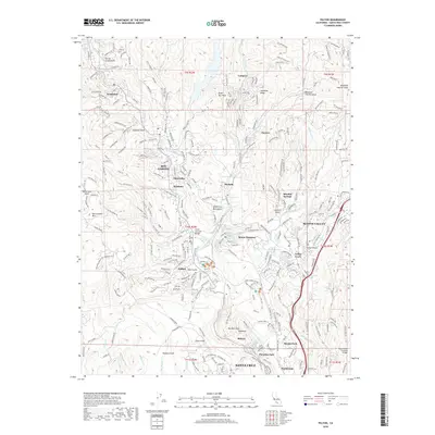
2018 Map of Felton
USGS Topo · Published 2018About this map
The San Lorenzo River valley defines this part of the Santa Cruz Mountains, where small communities and unique infrastructure follow the waterway’s winding path. In the north, Brookdale and Ben Lomond sit along the river, while the Roaring Camp & Big Trees Narrow Gauge RR tracks wind through the redwoods toward Felton. This map highlights the area's distinct architectural landmarks, including the Felton Covered Bridge and the Branciforte Covered Bridge to the southeast. Moving toward the coast, the terrain shifts into the suburban and recreation-focused landscapes of Pasatiempo and Paradise Park on the outskirts of Santa Cruz. To the east, Scotts Valley serves as a hub, connecting the mountain settlements like Zayante and Mount Hermon to the regional road network including Empire Grade.
Find a feature on this map
259 named features on this map. Tap any name to fly to it.
Don’t see what you’re looking for? This feature index may not catch every label — zoom into the map to look around manually.
Map Details
Editions of this 2018 Felton Map
This is the sole edition of this map. No revisions or reprints were ever made.
Other maps of this area

1902 · Santa Cruz
USGS Topo · 1:125,000

1912 · Capitola
USGS Topo · 1:62,500

1914 · Capitola
USGS Topo · 1:62,500

1916 · New Almaden
USGS Topo · 1:48,000

1919 · New Almaden
USGS Topo · 1:62,500

1940 · Capitola
USGS Topo · 1:62,500

1940 · Los Gatos
USGS Topo · 1:62,500

1943 · Los Gatos
USGS Topo · 1:62,500

1947 · San Francisco
USGS Topo · 1:250,000

1947 · San Jose
USGS Topo · 1:250,000