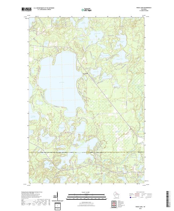
2022 Map of Fence Lake
USGS Topo · Published 2022About this map
The sprawling glacial waters of Fence Lake dominate this northern woodland landscape, situated at the border of Vilas and Oneida counties. The settlement of Marlands sits on the eastern shore of the main lake, positioned among a dense network of smaller bodies of water including Bolton Lake and Wishow Lake. The southern portion of the map reveals a transition into the Tomahawk River watershed, where Shishebogama Lake and Gunlock Lake create a complex shoreline that historically facilitated seasonal movement through the Northwoods. This 2022 survey documents the modern layout of recreation-based infrastructure, featuring numerous named points like Thoroughfare Point and Strawberry Point Dr. Local genealogists and land researchers can trace property access via dozens of specialized roads such as Pokegama Lake Trl and Squirrel Lake Rd, which connect the numerous lakefront developments and isolated springs like Mercer Springs.
Find a feature on this map
129 named features on this map. Tap any name to fly to it.
Don’t see what you’re looking for? This feature index may not catch every label — zoom into the map to look around manually.
Map Details
Editions of this 2022 Fence Lake Map
This is the sole edition of this map. No revisions or reprints were ever made.
Other maps of this area

1938 · Minocqua
USGS Topo · 1:48,000

1938 · Lac Du Flambeau
USGS Topo · 1:48,000

1939 · Trout Lake
USGS Topo · 1:48,000

1939 · Lac Du Flambeau
USGS Topo · 1:48,000

1939 · Winchester
USGS Topo · 1:48,000

1946 · Winchester
USGS Topo · 1:48,000

1946 · Minocqua
USGS Topo · 1:48,000

1946 · Lac Du Flambeau
USGS Topo · 1:48,000

1946 · Trout Lake
USGS Topo · 1:48,000

1949 · Trout Lake
USGS Topo · 1:48,000