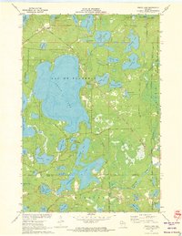
1971 Map of Fence Lake
USGS Topo · Published 1973About this map
The Lac du Flambeau Indian Reservation dominates this 1971 survey, showing a landscape defined by an intricate network of glacial lakes and wetlands. The massive basin of Fence Lake is the central geographic feature, surrounded by numerous smaller bodies of water including Shishebogama Lake, Whitefish Lake, and the Placid Twin Lakes. This era captures the region's transition into a premier Northwoods recreation destination while maintaining its traditional tribal and industrial roots.
Find a feature on this map
55 named features on this map. Tap any name to fly to it.
Don’t see what you’re looking for? This feature index may not catch every label — zoom into the map to look around manually.
Map Details
Editions of this 1971 Fence Lake Map
This is the sole edition of this map. No revisions or reprints were ever made.
Other maps of this area

1938 · Minocqua
USGS Topo · 1:48,000

1938 · Lac Du Flambeau
USGS Topo · 1:48,000

1939 · Trout Lake
USGS Topo · 1:48,000

1939 · Lac Du Flambeau
USGS Topo · 1:48,000

1939 · Winchester
USGS Topo · 1:48,000

1946 · Winchester
USGS Topo · 1:48,000

1946 · Minocqua
USGS Topo · 1:48,000

1946 · Lac Du Flambeau
USGS Topo · 1:48,000

1946 · Trout Lake
USGS Topo · 1:48,000

1949 · Trout Lake
USGS Topo · 1:48,000