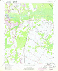
1954 Map of Fentress
USGS Topo · Published 1980About this map
The Albemarle and Chesapeake Canal Intracoastal Waterway cuts a straight path across this landscape, serving as a vital artery for mid-century water traffic. At Great Bridge, the infrastructure of the Great Bridge Lock and nearby Substation support this navigable corridor, while the Norfolk Southern tracks bisect the region's agricultural lands. The landscape is dotted with several rural settlements including Fentress, Oak Grove, and Hickory.
Find a feature on this map
28 named features on this map. Tap any name to fly to it.
Don’t see what you’re looking for? This feature index may not catch every label — zoom into the map to look around manually.
Map Details
Editions of this 1954 Fentress Map
4 editions found
Other maps of this area

1907 · Norfolk
USGS Topo · 1:125,000

1918 · Cape Henry
USGS Topo · 1:62,500

1919 · Cape Henry
USGS Topo · 1:62,500

1921 · Newport News
USGS Topo · 1:62,500

1939 · Moyock
USGS Topo · 1:62,500

1940 · Lake Drummond
USGS Topo · 1:62,500

1944 · Norfolk South
USGS Topo · 1:25,000

1945 · Lake Drummond
USGS Topo · 1:62,500

1946 · Moyock
USGS Topo · 1:62,500

1948 · Norfolk South
USGS Topo · 1:24,000