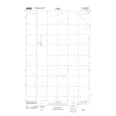
2012 Map of Ferney
USGS Topo · Published 2012About this map
Ferney serves as the central hub of this agricultural landscape in Brown County, defined by a rigid grid of section-line roads such as 139th St and 405th Ave. The settlement is compact, centered around Center St and 1st St, with the nearby Saint Pauls Cem providing a vital point of interest for genealogical research in this part of Garden Prairie Township. The terrain is marked by the meandering paths of Mud Cr in the northeast and Dry Run to the west, which contrast with the geometric precision of the surrounding farmland. The presence of the Hite Private Airport and the small Pigors Lake highlights the intersection of private land use and the natural prairie hydrology. This survey documents the area's rural character and transportation network in the early twenty-first century.
Find a feature on this map
25 named features on this map. Tap any name to fly to it.
Don’t see what you’re looking for? This feature index may not catch every label — zoom into the map to look around manually.
Map Details
Editions of this 2012 Ferney Map
This is the sole edition of this map. No revisions or reprints were ever made.
Other maps of this area

1894 · Conde
USGS Topo · 1:62,500

1895 · Aberdeen
USGS Topo · 1:125,000

1953 · Groton SW
USGS Topo · 1:24,000

1953 · Milbank
USGS Topo · 1:250,000

1954 · Groton
USGS Topo · 1:24,000

1954 · James
USGS Topo · 1:24,000

1954 · Ferney
USGS Topo · 1:24,000

1954 · Aberdeen
USGS Topo · 1:250,000

1956 · Aberdeen
USGS Topo · 1:250,000

1958 · Milbank
USGS Topo · 1:250,000
Featured Places
- Garden Prairie Township, SD
- Ferney, SD
- West Hanson Township, SD
- Bates Township, SD
- East Hanson Township, SD