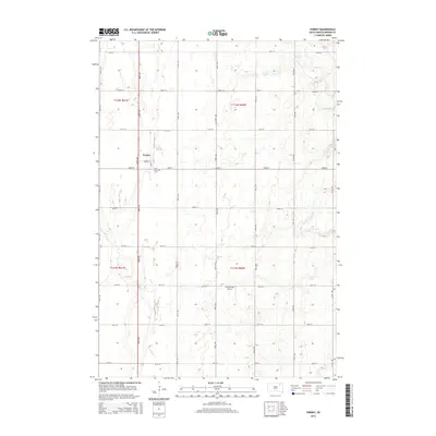
2015 Map of Ferney
USGS Topo · Published 2015About this map
Ferney serves as the central hub of this eastern Brown County landscape, where the flat agricultural terrain is organized by a precise grid of section lines and gravel roads. Located just south of the settlement, Saint Pauls Cem provides a significant touchstone for genealogical research in this rural township. The hydrology of the area is defined by seasonal watercourses and prairie depressions, including the winding Mud Cr in the northeast and the intermittent channel of Dry Run that cuts across the western sections. This 2015 survey reflects a classic Great Plains farming community, where land use is dominated by large-scale cultivation and occasional private infrastructure like the Hite Private Airport. Small natural features such as Pigors Lake punctuate the northern boundary, offering a glimpse into the localized drainage patterns of the region.
Find a feature on this map
27 named features on this map. Tap any name to fly to it.
Don’t see what you’re looking for? This feature index may not catch every label — zoom into the map to look around manually.
Map Details
Editions of this 2015 Ferney Map
This is the sole edition of this map. No revisions or reprints were ever made.
Other maps of this area

1894 · Conde
USGS Topo · 1:62,500

1895 · Aberdeen
USGS Topo · 1:125,000

1953 · Groton SW
USGS Topo · 1:24,000

1953 · Milbank
USGS Topo · 1:250,000

1954 · Groton
USGS Topo · 1:24,000

1954 · James
USGS Topo · 1:24,000

1954 · Ferney
USGS Topo · 1:24,000

1954 · Aberdeen
USGS Topo · 1:250,000

1956 · Aberdeen
USGS Topo · 1:250,000

1958 · Milbank
USGS Topo · 1:250,000
Featured Places
- Garden Prairie Township, SD
- Ferney, SD
- West Hanson Township, SD
- Bates Township, SD
- East Hanson Township, SD