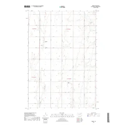
2017 Map of Ferney
USGS Topo · Published 2017About this map
Ferney occupies a central position in this survey of Brown County, South Dakota, situated amidst a landscape of prairie depressions and seasonal waterways. The settlement pattern follows the established township and range grid, where section lines double as local thoroughfares like 142nd St and 406th Ave. Local heritage is anchored by sites such as Saint Pauls Cem just south of the town site and Verdon Cem further south. The terrain is characterized by the intermittent flow of Dry Run and Mud Cr, alongside isolated water bodies like Pigors Lake to the east. The inclusion of Hite Private Airport reflects the continued reliance on private aviation in this agricultural region, where the vast open fields of the Garden Prairie Township dominate the horizon.
Find a feature on this map
29 named features on this map. Tap any name to fly to it.
Don’t see what you’re looking for? This feature index may not catch every label — zoom into the map to look around manually.
Map Details
Editions of this 2017 Ferney Map
This is the sole edition of this map. No revisions or reprints were ever made.
Other maps of this area

1894 · Conde
USGS Topo · 1:62,500

1895 · Aberdeen
USGS Topo · 1:125,000

1953 · Groton SW
USGS Topo · 1:24,000

1953 · Milbank
USGS Topo · 1:250,000

1954 · Groton
USGS Topo · 1:24,000

1954 · James
USGS Topo · 1:24,000

1954 · Ferney
USGS Topo · 1:24,000

1954 · Aberdeen
USGS Topo · 1:250,000

1956 · Aberdeen
USGS Topo · 1:250,000

1958 · Milbank
USGS Topo · 1:250,000
Featured Places
- Garden Prairie Township, SD
- Ferney, SD
- West Hanson Township, SD
- Bates Township, SD
- East Hanson Township, SD