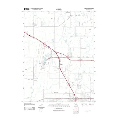
2012 Map of Ferrelview
USGS Topo · Published 2012About this map
Kansas City International Airport dominates the central landscape of this Platte County region, illustrating the massive scale of modern aviation infrastructure alongside long-established rural settlements. The map traces the growth of Ferrelview and Platte Gardens near the airport’s eastern periphery, while older community nodes like Hoover and Linkville maintain their distinct positions. A series of small family and community burial grounds, including Brasfield Cemetery and the uniquely named Pancake Cemetery, provide significant data points for genealogists tracking early local families.
Find a feature on this map
88 named features on this map. Tap any name to fly to it.
Don’t see what you’re looking for? This feature index may not catch every label — zoom into the map to look around manually.
Map Details
Editions of this 2012 Ferrelview Map
This is the sole edition of this map. No revisions or reprints were ever made.
Other maps of this area

1890 · Kansas City
USGS Topo · 1:125,000

1894 · Kansas City
USGS Topo · 1:125,000

1910 · Leavenworth
USGS Topo · 1:62,500

1914 · Smithville
USGS Topo · 1:62,500

1934 · Bonner Springs
USGS Topo · 1:48,000

1934 · Wolcott
USGS Topo · 1:24,000

1935 · North Kansas City
USGS Topo · 1:24,000

1940 · Bonner Springs
USGS Topo · 1:62,500
1940 · North Kansas City
USGS Topo · 1:31,680
1943 · Quindaro
USGS Topo · 1:31,680