Loading...
Loading map...2022 Map of Ferris
USGS Topo · Published 2022About this map
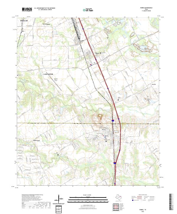
The Trinity River corridor and its associated bottomlands define the eastern edge of this landscape, where features like Gravel Slough and Cottonwood Cr snake through the floodplain. This recent survey captures the interface of the Dallas-Ellis county line, centered on the growing community of Ferris. The town's layout is well-documented, from the Ferris Memorial Park South to the residential streets branching off the primary north-south corridors.
Find a feature on this map
139 named features on this map. Tap any name to fly to it.
Don’t see what you’re looking for? This feature index may not catch every label — zoom into the map to look around manually.
Map Details
Date Portrayed2022
Date Published2022
PublisherU.S. Geological Survey
Map TypeTopographic
Scale1:24000
Physical Dimensions24 x 29 inches
Editions of this 2022 Ferris Map
This is the sole edition of this map. No revisions or reprints were ever made.
Historical Maps of Dallas Through Time
Featured Locations
Source Details
SourceU.S. Geological Survey
CopyrightPublic Domain