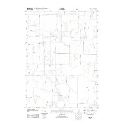
2012 Map of Ferry
USGS Topo · Published 2012About this map
The settlement of Ferry serves as the focal point for this Oceana County landscape, situated where the N Br White River winds through a network of rural roads and woodlots. This 2012 survey captures the area's transition into a recreational and residential corridor, evidenced by the presence of Camp Keewana and Camp Manistee near the riverbanks. The local genealogy is well-represented through three distinct burial sites: Ferry Cem, Otto Cem, and Woodward Cem, each marking historical family and community hubs. Notable landmarks like the Ferry Lookout Tower overlook a terrain defined by glacial hydrology, including Landin Lake, Gillon Lake, and several creeks such as Robinson Cr and Osborn Cr. The mapping of long-standing routes like Arthur Rd and Loop Rd provides a clear view of how these remote townships remain connected to the broader Michigan countryside.
Find a feature on this map
66 named features on this map. Tap any name to fly to it.
Don’t see what you’re looking for? This feature index may not catch every label — zoom into the map to look around manually.
Map Details
Editions of this 2012 Ferry Map
This is the sole edition of this map. No revisions or reprints were ever made.
Other maps of this area

1929 · Montague
USGS Topo · 1:48,000

1931 · Hart SE
USGS Topo · 1:31,680

1931 · Walkerville NE
USGS Topo · 1:31,680

1931 · Hart NE
USGS Topo · 1:31,680

1931 · Walkerville SW
USGS Topo · 1:31,680

1931 · Walkerville NW
USGS Topo · 1:31,680

1931 · Walkerville SE
USGS Topo · 1:31,680

1954 · Milwaukee
USGS Topo · 1:250,000

1958 · Milwaukee
USGS Topo · 1:250,000

1958 · Hesperia
USGS Topo · 1:62,500