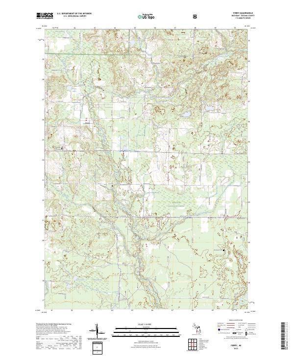
2023 Map of Ferry
USGS Topo · Published 2023About this map
Ferry serves as the focal point for this section of Oceana County, situated along a bend of the North Branch White River. The landscape is a complex mosaic of wetlands and water bodies, including Knox Swamp to the northwest and Lidkey Swamp to the southwest. For genealogists and local historians, the presence of the Ferry Township South Cem and the more easterly Woodward Cem provides specific points for family research.
Find a feature on this map
60 named features on this map. Tap any name to fly to it.
Don’t see what you’re looking for? This feature index may not catch every label — zoom into the map to look around manually.
Map Details
Editions of this 2023 Ferry Map
This is the sole edition of this map. No revisions or reprints were ever made.
Other maps of this area

1929 · Montague
USGS Topo · 1:48,000

1931 · Hart SE
USGS Topo · 1:31,680

1931 · Walkerville NE
USGS Topo · 1:31,680

1931 · Hart NE
USGS Topo · 1:31,680

1931 · Walkerville SW
USGS Topo · 1:31,680

1931 · Walkerville NW
USGS Topo · 1:31,680

1931 · Walkerville SE
USGS Topo · 1:31,680

1954 · Milwaukee
USGS Topo · 1:250,000

1958 · Milwaukee
USGS Topo · 1:250,000

1958 · Hesperia
USGS Topo · 1:62,500