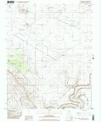
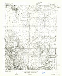
1997 Map of Ferry Swale
USGS Topo · Published 2003About this map
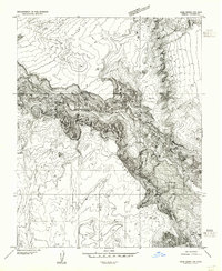
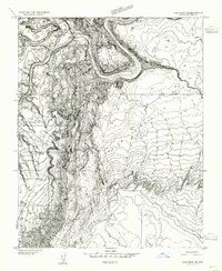
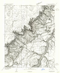
Vermilion Cliffs National Monument and the Glen Canyon National Recreation Area converge in this high-desert landscape near the Utah-Arizona border. The terrain is defined by dramatic geological features such as Thousand Pockets and Death Pockets, while the Colorado River winds through the southeastern corner, flanked by Eightmile Bar and Ninemile Draw. This 1990s field-checked survey illustrates the complex drainage systems of Ferry Swale Canyon and the Paria River Canyon.
Find a feature on this map
24 named features on this map. Tap any name to fly to it.
Don’t see what you’re looking for? This feature index may not catch every label — zoom into the map to look around manually.
Map Details
Editions of this 1997 Ferry Swale Map
This is the sole edition of this map. No revisions or reprints were ever made.
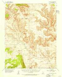
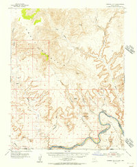
Other maps of this area

1886 · Escalante
USGS Topo · 1:250,000

1886 · Echo Cliffs
USGS Topo · 1:250,000

1891 · Echo Cliffs
USGS Topo · 1:250,000

1922 · Warm Creek
USGS Topo · 1:63,360
1951 · Lees Ferry NE
USGS Topo · 1:24,000
1953 · Nipple Butte
USGS Topo · 1:62,500
1953 · Gunsight Butte
USGS Topo · 1:62,500
1954 · Lees Ferry NW
USGS Topo · 1:24,000
1954 · Lees Ferry SE
USGS Topo · 1:24,000
1954 · Lees Ferry SW
USGS Topo · 1:24,000