
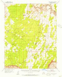
1954 Map of Lees Ferry NW
USGS Topo · Published 1955About this map
The Paria River carves a deep path through the Coconino County landscape, where the dramatic elevation changes of the Vermilion Cliffs dominate the eastern half of this 1954 survey. This preliminary edition shows a transition between high-desert plateaus and steep canyon walls, particularly where the Paria Plateau gives way to the river valley below. Settlement is non-existent on this sheet, which instead records the natural topography and remote navigation routes of the era, such as a solitary Jeep Trail winding across the flats of Horse Ridge. Local landmarks are primarily geographic, including the high point of Cedar Mtn to the north and the distinct Bush Head overlook. Notable water sources in this arid environment are captured at the Water Pockets, providing a rare glimpse into the vital hydrology that dictated movement through this part of the Arizona wilderness before modern development.
Find a feature on this map
10 named features on this map. Tap any name to fly to it.
Don’t see what you’re looking for? This feature index may not catch every label — zoom into the map to look around manually.
Map Details
Editions of this 1954 Lees Ferry NW Map
This is the sole edition of this map. No revisions or reprints were ever made.
Other maps of this area

1886 · Escalante
USGS Topo · 1:250,000

1886 · Echo Cliffs
USGS Topo · 1:250,000

1891 · Echo Cliffs
USGS Topo · 1:250,000

1951 · Lees Ferry NE
USGS Topo · 1:24,000

1953 · Nipple Butte
USGS Topo · 1:62,500

1954 · Paria Plateau SE
USGS Topo · 1:24,000

1954 · Lees Ferry SE
USGS Topo · 1:24,000

1954 · Lees Ferry SW
USGS Topo · 1:24,000

1954 · Lees Ferry
USGS Topo · 1:62,500
1954 · Paria Plateau
USGS Topo · 1:62,500