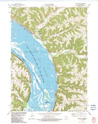
1983 Map of Ferryville
USGS Topo · Published 1983About this map
The Mississippi River dominates this early 1980s landscape, serving as both a state boundary and a major corridor for the Burlington Northern and Chicago Milwaukee St Paul and Pacific railroads. The river valley is largely occupied by the Upper Mississippi River Wild Life and Fish Refuge, including the expansive Winneshiek Lake and Capoli Slough. This environment creates a sharp contrast between the active waterway and the high, dissected bluffs of Freeman and Seneca townships.
Find a feature on this map
35 named features on this map. Tap any name to fly to it.
Don’t see what you’re looking for? This feature index may not catch every label — zoom into the map to look around manually.
Map Details
Editions of this 1983 Ferryville Map
This is the sole edition of this map. No revisions or reprints were ever made.
Other maps of this area

1903 · Waukon
USGS Topo · 1:125,000

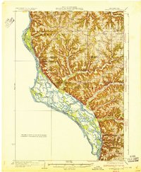
1924 · Gays Mills
USGS Topo · 1:62,500

1926 · Gays Mills
USGS Topo · 1:62,500

1926 · Wauzeka
USGS Topo · 1:62,500

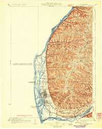
1929 · Ferryville
USGS Topo · 1:62,500

1929 · Prairie Du Chien
USGS Topo · 1:62,500
1932 · Ferryville
USGS Topo · 1:62,500
1932 · Prairie Du Chien
USGS Topo · 1:62,500

1958 · La Crosse
USGS Topo · 1:250,000

1961 · La Crosse
USGS Topo · 1:250,000