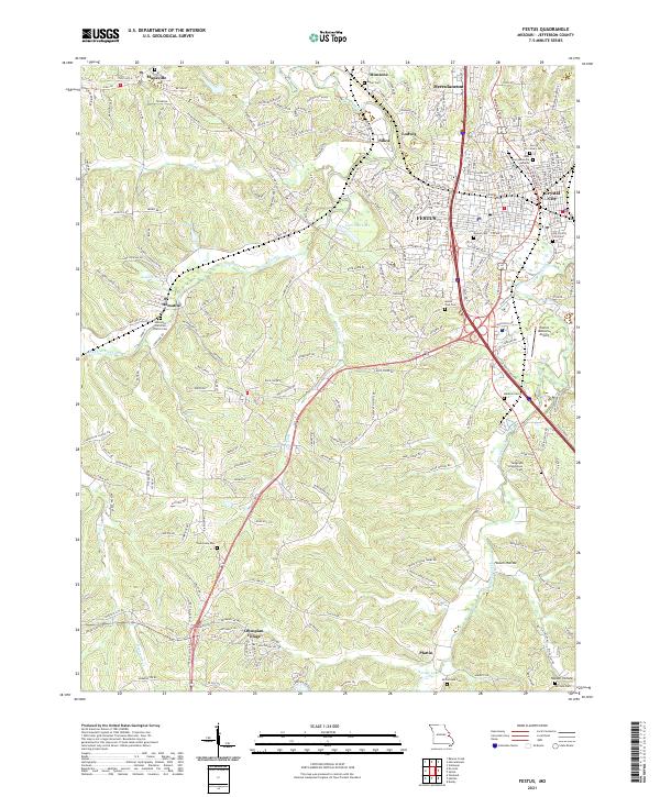
2021 Map of Festus
USGS Topo · Published 2021About this map
Festus and Crystal City serve as the primary urban anchors in this part of Jefferson County, where residential streets give way to the winding valleys of Joachim Creek and Plattin Creek. This landscape is characterized by its numerous family and community burial grounds, including the Old Crystal City Cem, Lawn Memorial Gardens, and the Telegraph Schoolhouse Cem, providing deep genealogical markers for the region. The map highlights the transition from industrial and municipal centers in Herculaneum and Silica to the more dispersed residential developments of Olympian Village and Mapaville.
Find a feature on this map
226 named features on this map. Tap any name to fly to it.
Don’t see what you’re looking for? This feature index may not catch every label — zoom into the map to look around manually.
Map Details
Editions of this 2021 Festus Map
This is the sole edition of this map. No revisions or reprints were ever made.
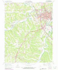
Historical Maps of Hematite Through Time
3 maps found

Featured Locations
- Central Township, MO
- Crystal City, River View Township
- Festus, River View Township
- Herculaneum, Joachim Township
- Olympian Village, Plattin Township