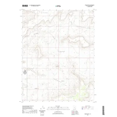
2020 Map of Fiddler Butte
USGS Topo · Published 2020About this map
Glen Canyon National Recreation Area land dominates the western portion of this topographic survey, revealing a landscape defined by dramatic geological formations and deep drainages. The central prominence of Fiddler Butte rises above a complex system of carved waterways, including Fiddler Cove Canyon and the winding course of Hatch Canyon. The terrain transitions from high plateaus like The Big Ridge to low-lying areas such as the Red Benches near the southern margin. Transportation in this high desert environment is limited to unpaved routes like N Hatch Canyon Rd and Poison Springs Wash Rd, which follow the natural contours of the canyons. The presence of features like The Block and South Block further illustrates the characteristic mesa-and-canyon topography of Garfield County.
Find a feature on this map
15 named features on this map. Tap any name to fly to it.
Don’t see what you’re looking for? This feature index may not catch every label — zoom into the map to look around manually.
Map Details
Editions of this 2020 Fiddler Butte Map
This is the sole edition of this map. No revisions or reprints were ever made.
Other maps of this area

1885 · San Rafael
USGS Topo · 1:250,000

1886 · Henry Mountains
USGS Topo · 1:250,000

1892 · Henry Mountains
USGS Topo · 1:250,000

1952 · Mouth of Dark Canyon
USGS Topo · 1:62,500

1952 · Orange Cliffs 3 SW
USGS Topo · 1:24,000

1952 · Hite
USGS Topo · 1:62,500

1953 · Orange Cliffs 3 SE
USGS Topo · 1:24,000

1953 · Orange Cliffs 4 NW
USGS Topo · 1:24,000

1953 · Orange Cliffs 3 NE
USGS Topo · 1:24,000

1953 · Orange Cliffs 4 SW
USGS Topo · 1:24,000