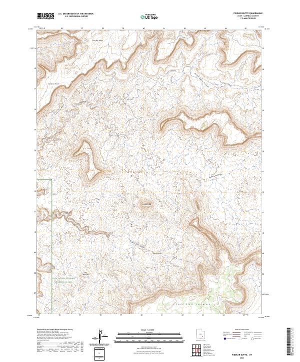
2023 Map of Fiddler Butte
USGS Topo · Published 2023About this map
Glen Canyon National Recreation Area dominates the southwestern portion of this landscape, marking a transition into protected canyonlands. The central prominence of Fiddler Butte stands as a clear navigational marker above the surrounding complex of erosion-carved terrain, including The Big Ridge and Buckacre Point. Access into this backcountry is defined by primitive routes like Poison Springs Wash Rd, which provide entry points into the deep drainage systems of North Hatch Canyon and South Hatch Canyon. These canyons eventually converge toward the Colorado River corridor beyond the sheet's edge. To the south, the Red Benches and a distinct landform known as The Block showcase the stair-step geography of the Colorado Plateau. This modern survey illustrates the current network of canyon roads and protected federal lands, documenting the intersection of recreation and high-desert geography.
Find a feature on this map
15 named features on this map. Tap any name to fly to it.
Don’t see what you’re looking for? This feature index may not catch every label — zoom into the map to look around manually.
Map Details
Editions of this 2023 Fiddler Butte Map
This is the sole edition of this map. No revisions or reprints were ever made.
Other maps of this area

1885 · San Rafael
USGS Topo · 1:250,000

1886 · Henry Mountains
USGS Topo · 1:250,000

1892 · Henry Mountains
USGS Topo · 1:250,000

1952 · Mouth of Dark Canyon
USGS Topo · 1:62,500

1952 · Orange Cliffs 3 SW
USGS Topo · 1:24,000

1952 · Hite
USGS Topo · 1:62,500

1953 · Orange Cliffs 3 SE
USGS Topo · 1:24,000

1953 · Orange Cliffs 4 NW
USGS Topo · 1:24,000

1953 · Orange Cliffs 3 NE
USGS Topo · 1:24,000

1953 · Orange Cliffs 4 SW
USGS Topo · 1:24,000