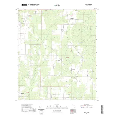
2021 Map of Fidelis
USGS Topo · Published 2021About this map
The W Fork Big Coldwater Cr and its numerous tributaries, including Cobb Cr and Juniper Cr, dominate this section of the Florida panhandle just south of the Alabama border. In the early 21st century, the landscape is defined by small agricultural settlements and a network of rural roads such as Dixonville Rd and Country Mill Rd. Significant local history and genealogy are preserved at the Old Fidelis Cem, Greenwood Cem, and Crossroads Cem, which serve the communities of Fidelis, Berrydale, and Dixonville. The map also details more contemporary features like the Thomas Farms Airport and localized water bodies such as James Thomas Pond and Picnic Lake, illustrating how the region's rural character persists despite modern infrastructure.
Find a feature on this map
114 named features on this map. Tap any name to fly to it.
Don’t see what you’re looking for? This feature index may not catch every label — zoom into the map to look around manually.
Map Details
Editions of this 2021 Fidelis Map
This is the sole edition of this map. No revisions or reprints were ever made.
Other maps of this area

1943 · Jay
USGS Topo · 1:62,500

1948 · Munson
USGS Topo · 1:62,500

1950 · Munson
USGS Topo · 1:62,500

1953 · Andalusia
USGS Topo · 1:250,000

1957 · Andalusia
USGS Topo · 1:250,000

1957 · Pensacola
USGS Topo · 1:250,000

1959 · Pensacola
USGS Topo · 1:250,000

1959 · Brewton South
USGS Topo · 1:24,000

1960 · Pensacola
USGS Topo · 1:250,000

1960 · Brewton South
USGS Topo · 1:24,000