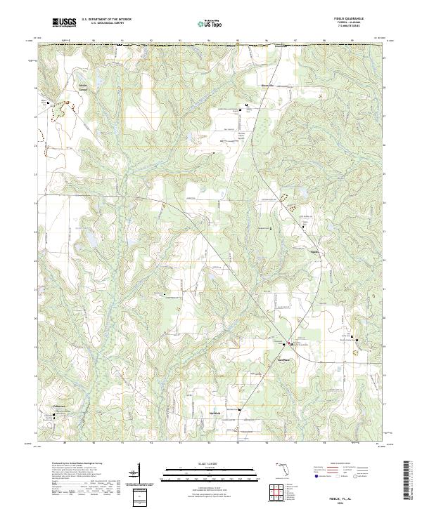
2024 Map of Fidelis
USGS Topo · Published 2024About this map
The Alabama and Florida state line divides this section of the Gulf Coastal Plain, where small rural communities like Fidelis and Berrydale anchor a landscape defined by the headwaters of the Escambia River basin. The geography is dominated by the winding paths of West Fork Big Coldwater Creek and Juniper Creek, which carve through a mosaic of timberland and family farms. Local history is deeply rooted in the scattered churches and family burial grounds that dot the secondary roads, including Mount Carmel Church and the Blocker Family Cem near Pine Grove Cem.
Find a feature on this map
110 named features on this map. Tap any name to fly to it.
Don’t see what you’re looking for? This feature index may not catch every label — zoom into the map to look around manually.
Map Details
Editions of this 2024 Fidelis Map
This is the sole edition of this map. No revisions or reprints were ever made.
Other maps of this area

1943 · Jay
USGS Topo · 1:62,500

1948 · Munson
USGS Topo · 1:62,500

1950 · Munson
USGS Topo · 1:62,500

1953 · Andalusia
USGS Topo · 1:250,000

1957 · Andalusia
USGS Topo · 1:250,000

1957 · Pensacola
USGS Topo · 1:250,000

1959 · Pensacola
USGS Topo · 1:250,000

1959 · Brewton South
USGS Topo · 1:24,000

1960 · Pensacola
USGS Topo · 1:250,000

1960 · Brewton South
USGS Topo · 1:24,000