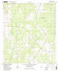
1994 Map of Fidelis
USGS Topo · Published 1998About this map
The Blackwater River State Forest dominates the eastern landscape of this Florida-Alabama borderlands survey, where the pine-heavy terrain is defined by the headwaters of Big Coldwater Creek. The agricultural and timber-driven settlements of Fidelis and Dixonville serve as local hubs, connected by a network of rural roads that cross the Alabama Florida state line. Genealogy researchers will find significant value in the documentation of several country churches and burial grounds, including Old Fidelis Cem and Whitfield Cem, which anchor the small communities of Berrydale and Cobbtown. Industrial activity is evident throughout the region, marked by numerous claypits and oil wells, reflecting the extraction economy typical of the Florida Panhandle during this era. The drainage patterns are intricate, with West Fork and East Fork feeding the larger creek systems that carve through the timberlands.
Find a feature on this map
40 named features on this map. Tap any name to fly to it.
Don’t see what you’re looking for? This feature index may not catch every label — zoom into the map to look around manually.
Map Details
Editions of this 1994 Fidelis Map
This is the sole edition of this map. No revisions or reprints were ever made.
Other maps of this area

1943 · Jay
USGS Topo · 1:62,500

1948 · Munson
USGS Topo · 1:62,500

1950 · Munson
USGS Topo · 1:62,500

1953 · Andalusia
USGS Topo · 1:250,000

1957 · Andalusia
USGS Topo · 1:250,000

1957 · Pensacola
USGS Topo · 1:250,000

1959 · Pensacola
USGS Topo · 1:250,000

1959 · Brewton South
USGS Topo · 1:24,000

1960 · Pensacola
USGS Topo · 1:250,000

1960 · Brewton South
USGS Topo · 1:24,000