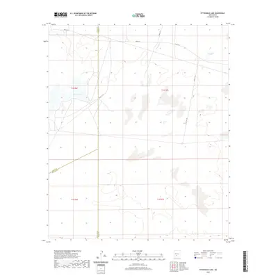
2020 Map of Fifteenmile Lake
USGS Topo · Published 2020About this map
Fifteenmile Lake sits in the high desert of south-central New Mexico, marking a landscape defined by seasonal hydrography and military administrative boundaries. This 2020 survey illustrates the remote basin where Big Salt Lake and the ephemeral drainage of Three Rivers are prominent natural features. The map highlights the complex jurisdictional intersection of Sierra, Doña Ana, and Otero counties, which meet in this arid expanse. The terrain is crisscrossed by specialized roadways like Wsmr P Rt 6 and Wsmr S Rt 297, reflecting the area's inclusion within a restricted military range. Researchers interested in the Tularosa Basin's geography will find the precise layout of township and range lines, such as t14s r7e, essential for locating specific land parcels and historical natural landmarks in an area with few permanent settlements.
Find a feature on this map
14 named features on this map. Tap any name to fly to it.
Don’t see what you’re looking for? This feature index may not catch every label — zoom into the map to look around manually.
Map Details
Editions of this 2020 Fifteenmile Lake Map
This is the sole edition of this map. No revisions or reprints were ever made.
Other maps of this area

1916 · Tularosa
USGS Topo · 1:125,000

1916 · Point Of Sands
USGS Topo · 1:125,000

1947 · Point Of Sands 2
USGS Topo · 1:62,500

1948 · Lumley Lake
USGS Topo · 1:62,500

1948 · Tularosa
USGS Topo · 1:62,500

1948 · Holloman
USGS Topo · 1:62,500

1954 · Tularosa
USGS Topo · 1:250,000

1955 · Las Cruces
USGS Topo · 1:250,000

1958 · Las Cruces
USGS Topo · 1:250,000

1958 · Tularosa
USGS Topo · 1:250,000