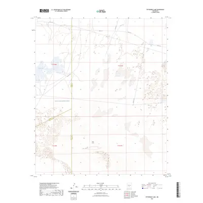
2023 Map of Fifteenmile Lake
USGS Topo · Published 2023About this map
White Sands Missile Range dominates this landscape in southern New Mexico, where the high desert meets a complex of ephemeral basins and specialized military infrastructure. The terrain is characterized by the expansive White Sands formation and a series of dry lake beds, most notably Fifteenmile Lake and Big Salt Lake. This area serves as a critical junction where Otero, Sierra, and Doña Ana counties meet, illustrating the administrative complexity of managing such a vast federal reservation. The map details a network of restricted military corridors including Wsmr P RT 6 and Wsmr S RT 297, which cut across the desert floor. The drainage of Three Rivers enters the northern sector, providing a rare hydrological feature in an otherwise arid environment defined by salt flats and shifting sands.
Find a feature on this map
16 named features on this map. Tap any name to fly to it.
Don’t see what you’re looking for? This feature index may not catch every label — zoom into the map to look around manually.
Map Details
Editions of this 2023 Fifteenmile Lake Map
This is the sole edition of this map. No revisions or reprints were ever made.
Other maps of this area

1916 · Tularosa
USGS Topo · 1:125,000

1916 · Point Of Sands
USGS Topo · 1:125,000

1947 · Point Of Sands 2
USGS Topo · 1:62,500

1948 · Lumley Lake
USGS Topo · 1:62,500

1948 · Tularosa
USGS Topo · 1:62,500

1948 · Holloman
USGS Topo · 1:62,500

1954 · Tularosa
USGS Topo · 1:250,000

1955 · Las Cruces
USGS Topo · 1:250,000

1958 · Las Cruces
USGS Topo · 1:250,000

1958 · Tularosa
USGS Topo · 1:250,000