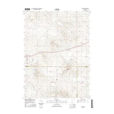
2015 Map of Fillmore
USGS Topo · Published 2015About this map
The city of Cascade and the settlement of Fillmore anchor this 2015 study of the rolling eastern Iowa landscape where Dubuque, Jones, and Jackson counties meet. The drainage of Whitewater Creek dominates the central topography, winding past the White Water Creek Bridge and Moore's Ford Bridge. The southern portion of the map is defined by the North Fork Maquoketa River and its various tributaries, including Lost Cr and Farm Cr.
Find a feature on this map
68 named features on this map. Tap any name to fly to it.
Don’t see what you’re looking for? This feature index may not catch every label — zoom into the map to look around manually.
Map Details
Editions of this 2015 Fillmore Map
This is the sole edition of this map. No revisions or reprints were ever made.
Other maps of this area

1891 · Monticello
USGS Topo · 1:62,500

1891 · Baldwin
USGS Topo · 1:62,500

1900 · Anamosa
USGS Topo · 1:125,000

1901 · Peosta
USGS Topo · 1:125,000

1959 · Dubuque
USGS Topo · 1:250,000

1961 · Dubuque
USGS Topo · 1:250,000

1962 · Dubuque
USGS Topo · 1:250,000
1965 · Dyersville East
USGS Topo · 1:24,000
1966 · Bernard
USGS Topo · 1:24,000
1966 · Fillmore
USGS Topo · 1:24,000