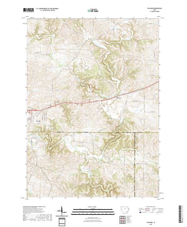
2022 Map of Fillmore
USGS Topo · Published 2022About this map
Cascade and the surrounding tri-county borderlands of Dubuque, Jones, and Jackson counties are defined by the winding course of the North Fork Maquoketa River and its deeply carved tributaries. This landscape shows the significant topographic relief of the Whitewater Canyon area, where Whitewater Creek cuts through the terrain southeast of the settlement of Fillmore. The drainage network, including Johns Creek, Lost Cr, and Farm Cr, dictates the placement of rural roads that often follow the ridgelines or valley floors.
Find a feature on this map
64 named features on this map. Tap any name to fly to it.
Don’t see what you’re looking for? This feature index may not catch every label — zoom into the map to look around manually.
Map Details
Editions of this 2022 Fillmore Map
This is the sole edition of this map. No revisions or reprints were ever made.
Other maps of this area

1891 · Monticello
USGS Topo · 1:62,500

1891 · Baldwin
USGS Topo · 1:62,500

1900 · Anamosa
USGS Topo · 1:125,000

1901 · Peosta
USGS Topo · 1:125,000

1959 · Dubuque
USGS Topo · 1:250,000

1961 · Dubuque
USGS Topo · 1:250,000

1962 · Dubuque
USGS Topo · 1:250,000
1965 · Dyersville East
USGS Topo · 1:24,000
1966 · Bernard
USGS Topo · 1:24,000
1966 · Fillmore
USGS Topo · 1:24,000