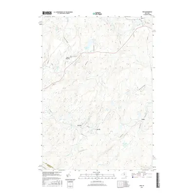
2016 Map of Fine
USGS Topo · Published 2016About this map
East Pitcairn and the surrounding woodlands of the Adirondack Park Preserve define this section of Northern New York. The landscape is heavily marked by the drainage of the Oswegatchie River and its various tributaries, including Yellow Creek and Greenwood Creek. Small settlements and naming conventions reflect a history of timber and mining, seen in places like Jayville, Briggs, and Kalurah. The terrain is characterized by numerous small bodies of water such as Portaferry Lake, Jenny Lake, and Bear Lake, alongside significant geologic features like The Gulf. These water sources and the local road network, including Briggs Switch Road and Camp Portaferry Road, illustrate the connectivity between these remote Adirondack outposts. Local genealogists will find the East Pitcairn Cemetery and named homestead roads useful for tracing family ties in this rugged portion of the St. Lawrence and Lewis County border.
Find a feature on this map
51 named features on this map. Tap any name to fly to it.
Don’t see what you’re looking for? This feature index may not catch every label — zoom into the map to look around manually.
Map Details
Editions of this 2016 Fine Map
This is the sole edition of this map. No revisions or reprints were ever made.
Other maps of this area

1913 · Lake Bonaparte
USGS Topo · 1:62,500

1915 · Gouverneur
USGS Topo · 1:62,500

1915 · Russell
USGS Topo · 1:62,500

1916 · Lake Bonaparte
USGS Topo · 1:62,500

1916 · Oswegatchie
USGS Topo · 1:62,500

1918 · Russell
USGS Topo · 1:62,500

1918 · Oswegatchie
USGS Topo · 1:62,500

1937 · Gouverneur
USGS Topo · 1:62,500

1948 · Ogdensburg
USGS Topo · 1:250,000

1951 · Ogdensburg
USGS Topo · 1:250,000