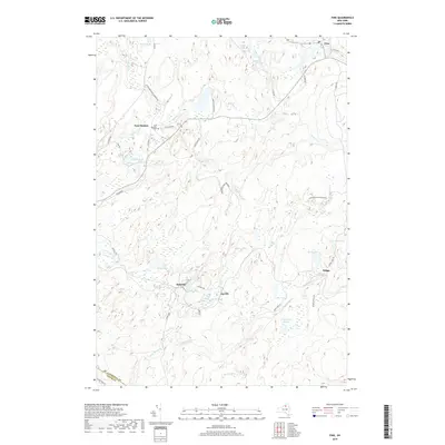
2019 Map of Fine
USGS Topo · Published 2019About this map
East Pitcairn and the surrounding woodlands of the Adirondack Park Preserve define the landscape of this northern New York survey. Small settlements including Jayville, Kalurah, and Briggs are connected by a network of local roads like Jayville Rd and Briggs Switch Rd, reflecting the scattered residential and logging character of the region. The map provides a detailed look at the hydraulic network that shaped local development, from the Oswegatchie River in the northeast to the numerous glacial lakes such as Jenny Lake, Snyder Lake, and Bear Lake. Natural landmarks like Greenwood Falls and Rock Dam Falls indicate the elevation changes common to this part of the Western Adirondacks. Genealogists may find the East Pitcairn Cem particularly useful for identifying family sites in this sparsely populated area on the border of St. Lawrence and Lewis Counties.
Find a feature on this map
51 named features on this map. Tap any name to fly to it.
Don’t see what you’re looking for? This feature index may not catch every label — zoom into the map to look around manually.
Map Details
Editions of this 2019 Fine Map
This is the sole edition of this map. No revisions or reprints were ever made.
Other maps of this area

1913 · Lake Bonaparte
USGS Topo · 1:62,500

1915 · Gouverneur
USGS Topo · 1:62,500

1915 · Russell
USGS Topo · 1:62,500

1916 · Lake Bonaparte
USGS Topo · 1:62,500

1916 · Oswegatchie
USGS Topo · 1:62,500

1918 · Russell
USGS Topo · 1:62,500

1918 · Oswegatchie
USGS Topo · 1:62,500

1937 · Gouverneur
USGS Topo · 1:62,500

1948 · Ogdensburg
USGS Topo · 1:250,000

1951 · Ogdensburg
USGS Topo · 1:250,000