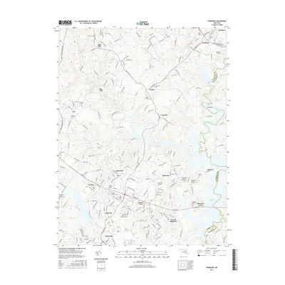
2016 Map of Finksburg
USGS Topo · Published 2016About this map
Sykesville and the surrounding Carroll County countryside are defined by a complex network of suburban residential development and protected natural spaces as they appeared in the early 21st century. The southeastern reaches of this survey are dominated by the winding fingers of Liberty Lake, where the shoreline meets small communities like Oakland and Shervettes Corner. The landscape is notably dotted with numerous historical burial grounds, including the Springfield State Hospital Cem and Beth Jacob Cem, offering a detailed record for genealogical research in this long-settled region. Small aviation facilities like Hoby Wolf Airport and Reservoir Airport sit alongside residential clusters such as Gamber and Finksburg. The terrain follows the drainage of Morgan Run and Piney Run, where the transition from agricultural roots to modern commuter settlements is visible in the dense web of naming for local roads and subdivisions.
Find a feature on this map
207 named features on this map. Tap any name to fly to it.
Don’t see what you’re looking for? This feature index may not catch every label — zoom into the map to look around manually.
Map Details
Editions of this 2016 Finksburg Map
This is the sole edition of this map. No revisions or reprints were ever made.
Other maps of this area

1892 · Ellicott
USGS Topo · 1:62,500

1893 · Frederick
USGS Topo · 1:125,000

1894 · Ellicott
USGS Topo · 1:62,500

1894 · Frederick
USGS Topo · 1:125,000

1905 · Westminster
USGS Topo · 1:62,500

1906 · Ellicott
USGS Topo · 1:62,500

1908 · Patapsco
USGS Topo · 1:125,000

1909 · Mount Airy
USGS Topo · 1:62,500

1911 · Taneytown
USGS Topo · 1:62,500

1942 · Gettysburg
USGS Topo · 1:125,000