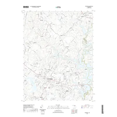
2019 Map of Finksburg
USGS Topo · Published 2019About this map
Eldersburg and its surrounding communities are deeply shaped by the expansive waters of Liberty Lake and the Liberty Reservoir, which define the eastern and central landscape. The area is characterized by numerous small settlements and family-named locales such as Gamber, Louisville, and Johnsville, many of which grew around early crossroads and local industry. The map reveals a dense concentration of ecclesiastical and funerary sites, including the Springfield State Hospital Cem and Beth Jacob Cem near Finksburg. These landmarks, along with many Methodist cemeteries like Harmony Grove Cem, provide a significant record of the region’s denominational history and community growth. Aviation interest is noted by the presence of Hoby Wolf Airport and Reservoir Airport, while natural drainage flows through Morgan Run and Piney Run toward the regional reservoir system.
Find a feature on this map
53 named features on this map. Tap any name to fly to it.
Don’t see what you’re looking for? This feature index may not catch every label — zoom into the map to look around manually.
Map Details
Editions of this 2019 Finksburg Map
This is the sole edition of this map. No revisions or reprints were ever made.
Other maps of this area

1892 · Ellicott
USGS Topo · 1:62,500

1893 · Frederick
USGS Topo · 1:125,000

1894 · Ellicott
USGS Topo · 1:62,500

1894 · Frederick
USGS Topo · 1:125,000

1905 · Westminster
USGS Topo · 1:62,500

1906 · Ellicott
USGS Topo · 1:62,500

1908 · Patapsco
USGS Topo · 1:125,000

1909 · Mount Airy
USGS Topo · 1:62,500

1911 · Taneytown
USGS Topo · 1:62,500

1942 · Gettysburg
USGS Topo · 1:125,000