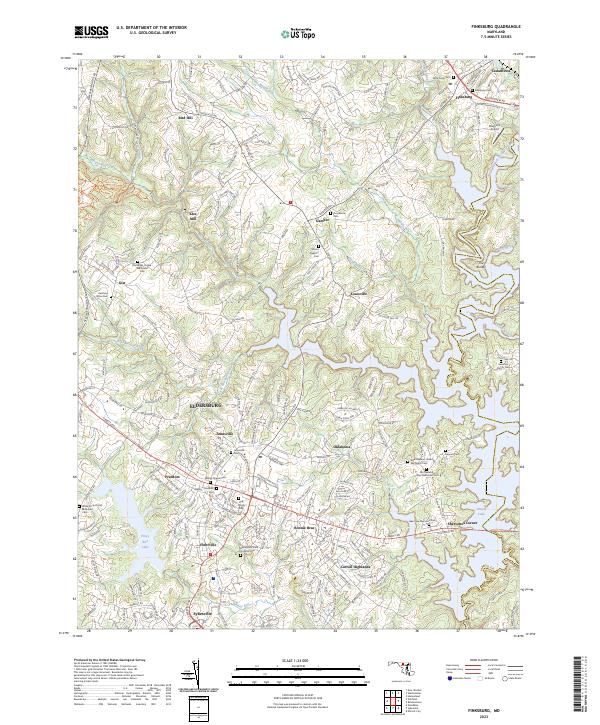
2023 Map of Finksburg
USGS Topo · Published 2023About this map
Sykesville and the sprawling suburbs of south-central Carroll County characterize this modern landscape, where historical rural roots meet the expansion of the Baltimore metropolitan area. The southern edge is defined by the waters of Piney Run Lake and the winding Piney Run, while the eastern border follows the jagged shoreline of Liberty Lake and the North Branch Patapsco River. The map reveals a high concentration of small family and community burial sites, from the Baseman Family Cem and Bennett Cem to larger institutional markers like the Springfield State Hospital Cem.
Find a feature on this map
210 named features on this map. Tap any name to fly to it.
Don’t see what you’re looking for? This feature index may not catch every label — zoom into the map to look around manually.
Map Details
Editions of this 2023 Finksburg Map
This is the sole edition of this map. No revisions or reprints were ever made.
Other maps of this area

1892 · Ellicott
USGS Topo · 1:62,500

1893 · Frederick
USGS Topo · 1:125,000

1894 · Ellicott
USGS Topo · 1:62,500

1894 · Frederick
USGS Topo · 1:125,000

1905 · Westminster
USGS Topo · 1:62,500

1906 · Ellicott
USGS Topo · 1:62,500

1908 · Patapsco
USGS Topo · 1:125,000

1909 · Mount Airy
USGS Topo · 1:62,500

1911 · Taneytown
USGS Topo · 1:62,500

1942 · Gettysburg
USGS Topo · 1:125,000