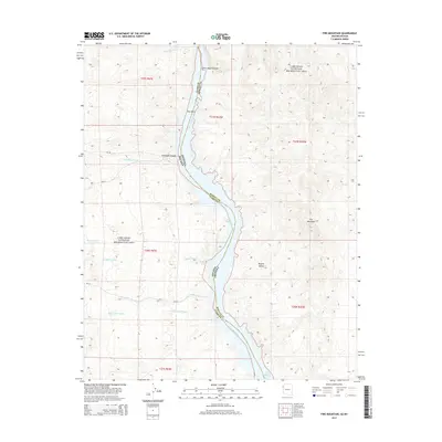
2014 Map of Fire Mountain
USGS Topo · Published 2014About this map
Lake Mohave and the Colorado River dominate this desert landscape, forming the state boundary between Nevada and Arizona. The terrain is defined by a series of significant drainage systems, including Techatticup Wash, Capitol Wash, and Aztec Wash, which carve through the arid heights of the Mojave Desert. This 2014 survey captures the area within the Lake Mead National Recreation Area, highlighting geological features like Lower Black Canyon and the prominent peak of Fire Mountain to the east.
Find a feature on this map
23 named features on this map. Tap any name to fly to it.
Don’t see what you’re looking for? This feature index may not catch every label — zoom into the map to look around manually.
Map Details
Editions of this 2014 Fire Mountain Map
This is the sole edition of this map. No revisions or reprints were ever made.
Other maps of this area

1886 · Camp Mohave
USGS Topo · 1:250,000

1892 · Camp Mohave
USGS Topo · 1:250,000

1926 · Nelson
USGS Topo · 1:96,000

1942 · Camp Mohave
USGS Topo · 1:250,000

1947 · Kingman
USGS Topo · 1:250,000

1948 · Kingman
USGS Topo · 1:250,000

1954 · Kingman
USGS Topo · 1:250,000

1955 · Kingman
USGS Topo · 1:250,000

1958 · Kingman
USGS Topo · 1:250,000
1958 · Nelson
USGS Topo · 1:62,500