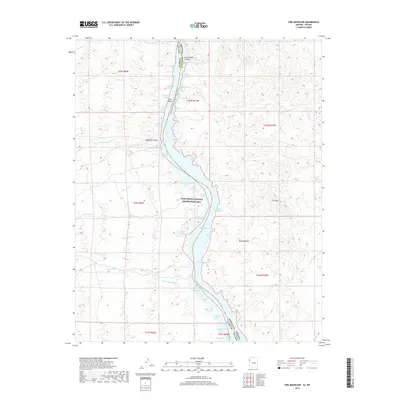
2018 Map of Fire Mountain
USGS Topo · Published 2018About this map
Lake Mohave dominates this portion of the Lake Mead National Recreation Area, where the Colorado River marks the border between Nevada and Arizona. The landscape is defined by the sharp transition from the arid Mojave Desert to the water-filled recesses of Lower Black Canyon. Historically significant drainage systems like Eldorado Canyon, Techatticup Wash, and Capitol Wash converge on the reservoir, creating a complex shoreline of named inlets including Techatticup Cove and Capital Camp Cove. Mining history is evidenced by the Pope Mine near the river and the Porter Mine Cove, indicating the mineral extraction that once characterized these remote desert canyons. Modern recreation and conservation are highlighted by the Black Canyon National Water Trail, which follows the river's path below Fire Mtn.
Find a feature on this map
52 named features on this map. Tap any name to fly to it.
Don’t see what you’re looking for? This feature index may not catch every label — zoom into the map to look around manually.
Map Details
Editions of this 2018 Fire Mountain Map
This is the sole edition of this map. No revisions or reprints were ever made.
Other maps of this area

1886 · Camp Mohave
USGS Topo · 1:250,000

1892 · Camp Mohave
USGS Topo · 1:250,000

1926 · Nelson
USGS Topo · 1:96,000

1942 · Camp Mohave
USGS Topo · 1:250,000

1947 · Kingman
USGS Topo · 1:250,000

1948 · Kingman
USGS Topo · 1:250,000

1954 · Kingman
USGS Topo · 1:250,000

1955 · Kingman
USGS Topo · 1:250,000

1958 · Kingman
USGS Topo · 1:250,000
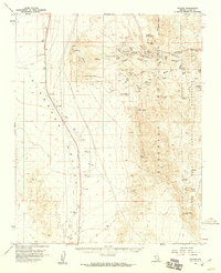
1958 · Nelson
USGS Topo · 1:62,500