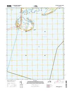
2016 Map of Fishermans Island
USGS Topo · Published 2016About this map
Fishermans Island and its surrounding coastal features mark the vital maritime junction where the Chesapeake Bay meets the Atlantic Ocean. This landscape is defined by the massive engineering of the Chesapeake Bay Bridge-Tunnel, which spans the open water and connects the tip of the Delmarva Peninsula at Wise Point toward the mainland. The terrain is a complex of shifting sands and tidal inlets, including Smith Island and Adams Island, separated by the Smith Island Inlet. Below the water line, the navigational challenges of the mouth of the bay are evident in hazards like Nautilus Shoal and Latimer Shoal. The presence of the Intracoastal Waterway north of Cape Charles highlights the area's continued importance for sheltered marine transit amidst the more volatile waters of the North Channel.
Find a feature on this map
21 named features on this map. Tap any name to fly to it.
Don’t see what you’re looking for? This feature index may not catch every label — zoom into the map to look around manually.
Map Details
Editions of this 2016 Fishermans Island Map
This is the sole edition of this map. No revisions or reprints were ever made.
Other maps of this area

1893 · Virginia Beach
USGS Topo · 1:125,000

1907 · Norfolk
USGS Topo · 1:125,000

1918 · Cape Henry
USGS Topo · 1:62,500

1919 · Cape Henry
USGS Topo · 1:62,500

1943 · Elliots Creek
USGS Topo · 1:25,000

1943 · Townsend
USGS Topo · 1:24,000

1943 · Richmond
USGS Topo · 1:250,000

1946 · Eastville
USGS Topo · 1:250,000

1946 · Currituck Sound
USGS Topo · 1:250,000

1949 · Richmond
USGS Topo · 1:250,000