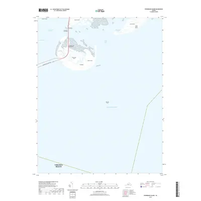
2019 Map of Fishermans Island
USGS Topo · Published 2019About this map
Fishermans Island stands as the centerpiece of this coastal survey, marking the southern tip of the Delmarva Peninsula where the Atlantic Ocean meets the mouth of the Chesapeake Bay. This modern record details the intricate maritime environment of the Virginia Beach vicinity, highlighting the critical transit corridor formed by the Chesapeake Bay Bridge-Tunnel and the Fishermans Inlet Bridge. These structures provide the only land link across the water, connecting Wise Point at the edge of Cape Charles to the mainland to the south.
Find a feature on this map
19 named features on this map. Tap any name to fly to it.
Don’t see what you’re looking for? This feature index may not catch every label — zoom into the map to look around manually.
Map Details
Editions of this 2019 Fishermans Island Map
This is the sole edition of this map. No revisions or reprints were ever made.
Other maps of this area

1893 · Virginia Beach
USGS Topo · 1:125,000

1907 · Norfolk
USGS Topo · 1:125,000

1918 · Cape Henry
USGS Topo · 1:62,500

1919 · Cape Henry
USGS Topo · 1:62,500

1943 · Elliots Creek
USGS Topo · 1:25,000

1943 · Townsend
USGS Topo · 1:24,000

1943 · Richmond
USGS Topo · 1:250,000

1946 · Eastville
USGS Topo · 1:250,000

1946 · Currituck Sound
USGS Topo · 1:250,000

1949 · Richmond
USGS Topo · 1:250,000