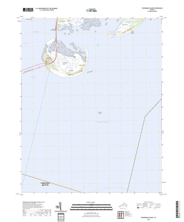
2022 Map of Fishermans Island
USGS Topo · Published 2022About this map
Fishermans Island stands as the southernmost tip of the Delmarva Peninsula, marking the threshold between the Chesapeake Bay and the Atlantic Ocean. This maritime landscape is defined by its shifting sands and complex coastal hydrography, where the Intracoastal Waterway threads through the North Channel just west of Wise Point. The map illustrates a dynamic barrier island system, including the elongated stretch of Smith Island and Smith Island Beach, separated from the mainland by tidal features like Raccoon Creek and Blackbeards Creek. To the south, the vast expanse of the ocean is broken only by underwater hazards like Nautilus Shoal. The presence of Adams Island and the marshy flats of The Isaacs highlights the delicate, evolving nature of this protected coastal environment at the entrance to Cape Charles.
Find a feature on this map
17 named features on this map. Tap any name to fly to it.
Don’t see what you’re looking for? This feature index may not catch every label — zoom into the map to look around manually.
Map Details
Editions of this 2022 Fishermans Island Map
This is the sole edition of this map. No revisions or reprints were ever made.
Other maps of this area

1893 · Virginia Beach
USGS Topo · 1:125,000

1907 · Norfolk
USGS Topo · 1:125,000

1918 · Cape Henry
USGS Topo · 1:62,500

1919 · Cape Henry
USGS Topo · 1:62,500

1943 · Elliots Creek
USGS Topo · 1:25,000

1943 · Townsend
USGS Topo · 1:24,000

1943 · Richmond
USGS Topo · 1:250,000

1946 · Eastville
USGS Topo · 1:250,000

1946 · Currituck Sound
USGS Topo · 1:250,000

1949 · Richmond
USGS Topo · 1:250,000