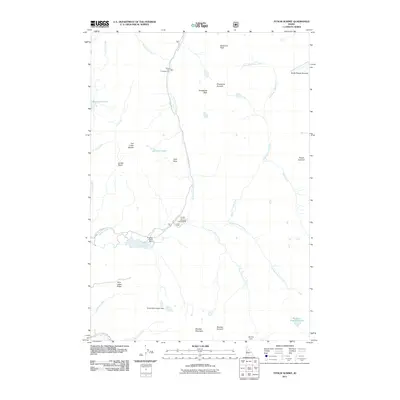
2011 Map of Fitsum Summit
USGS Topo · Published 2011About this map
Lick Creek Rd serves as the primary artery through this high-altitude landscape in Valley County, providing access to essential recreational sites like Black Lee Campground and Lake Fork Campground. The area is defined by its complex drainage network, where the North Fork Lake Fork and its various branches, including the Middle Fork Lake Fork and South Fork Lake Fork, converge near Lake Fork. The presence of several small-scale water management structures, such as Browns Pond Dam, Molony Dam, and Shaw Twins-Upper Dam, suggests a history of managing runoff for local downstream needs.
Find a feature on this map
37 named features on this map. Tap any name to fly to it.
Don’t see what you’re looking for? This feature index may not catch every label — zoom into the map to look around manually.
Map Details
Editions of this 2011 Fitsum Summit Map
This is the sole edition of this map. No revisions or reprints were ever made.
Other maps of this area

1911 · Meadows
USGS Topo · 1:125,000

1938 · Riggins
USGS Topo · 1:96,000

1945 · Riggins
USGS Topo · 1:125,000

1955 · Baker
USGS Topo · 1:250,000

1955 · Grangeville
USGS Topo · 1:250,000

1956 · Elk City
USGS Topo · 1:250,000

1957 · Challis
USGS Topo · 1:250,000

1959 · Baker
USGS Topo · 1:250,000

1959 · Grangeville
USGS Topo · 1:250,000

1960 · Elk City
USGS Topo · 1:250,000