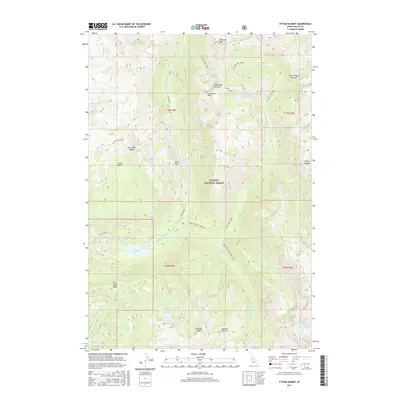
2017 Map of Fitsum Summit
USGS Topo · Published 2017About this map
Payette National Forest dominates this high-elevation terrain, where the headwaters of several major river forks emerge from the granite ridges of Valley County. The drainage network is complex, characterized by the Middle Fork Lake Fork and the South Fork Lake Fork, which originate near numerous alpine water bodies such as Box Lake, Maki Lake, and the Shaw Twin Lakes Upper. High peaks including Sawtooth Peak, Snowslide Peak, and Boulder Mountain define the vertical relief, separated by significant topographic passes like Fall Creek Saddle and Fitsum Summit.
Find a feature on this map
47 named features on this map. Tap any name to fly to it.
Don’t see what you’re looking for? This feature index may not catch every label — zoom into the map to look around manually.
Map Details
Editions of this 2017 Fitsum Summit Map
This is the sole edition of this map. No revisions or reprints were ever made.
Other maps of this area

1911 · Meadows
USGS Topo · 1:125,000

1938 · Riggins
USGS Topo · 1:96,000

1945 · Riggins
USGS Topo · 1:125,000

1955 · Baker
USGS Topo · 1:250,000

1955 · Grangeville
USGS Topo · 1:250,000

1956 · Elk City
USGS Topo · 1:250,000

1957 · Challis
USGS Topo · 1:250,000

1959 · Baker
USGS Topo · 1:250,000

1959 · Grangeville
USGS Topo · 1:250,000

1960 · Elk City
USGS Topo · 1:250,000