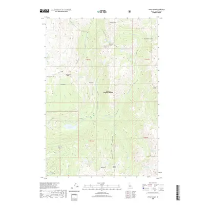
2020 Map of Fitsum Summit
USGS Topo · Published 2020About this map
Payette National Forest dominates this high-elevation terrain in Valley County, where sharp peaks and alpine lakes define the watershed. The landscape is structured by several significant ridges, including Snowslide Summit and Boulder Mtn, which separate numerous glacial basins. Water travels through a complex drainage system, from the Middle Fork Lake Fork to the N Fork Fitsum Cr. Human infrastructure is sparse, concentrated primarily on Lick Creek Rd and the Lake Fork First Bridge, providing limited access to the interior. For those studying the geography of central Idaho, the map details many high-altitude landmarks such as Sawtooth Peak and the Shaw Twin Lakes. The presence of features like Jumbo Basin and Slick Rock illustrates the glacially carved nature of this primitive mountain wilderness.
Find a feature on this map
50 named features on this map. Tap any name to fly to it.
Don’t see what you’re looking for? This feature index may not catch every label — zoom into the map to look around manually.
Map Details
Editions of this 2020 Fitsum Summit Map
This is the sole edition of this map. No revisions or reprints were ever made.
Other maps of this area

1911 · Meadows
USGS Topo · 1:125,000

1938 · Riggins
USGS Topo · 1:96,000

1945 · Riggins
USGS Topo · 1:125,000

1955 · Baker
USGS Topo · 1:250,000

1955 · Grangeville
USGS Topo · 1:250,000

1956 · Elk City
USGS Topo · 1:250,000

1957 · Challis
USGS Topo · 1:250,000

1959 · Baker
USGS Topo · 1:250,000

1959 · Grangeville
USGS Topo · 1:250,000

1960 · Elk City
USGS Topo · 1:250,000