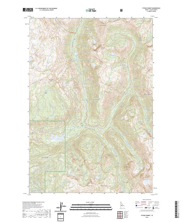
2024 Map of Fitsum Summit
USGS Topo · Published 2024About this map
Payette National Forest encompasses the high-altitude terrain of the Salmon River Mountains captured in this recent survey. The landscape is defined by its complex drainage network, where the North Fork Lake Fork, Middle Fork Lake Fork, and South Fork Lake Fork converge. Historic access routes like Lick Creek Rd and Boulder Lake Rd navigate the steep topography, providing passage to high basins containing Snowslide Lake, Maki Lake, and Anderson Lake. Prominent summits such as Sawtooth Peak, Boulder Mtn, and the namesake Fitsum Summit stand as significant landmarks for those tracing the geographic divide between these glacial drainages. For researchers, the map details established trails including the Box Lake Trl and Paddy Flat-Lake Fork Creek Trl, which follow the natural contours of the mountain passes and valley floors.
Find a feature on this map
49 named features on this map. Tap any name to fly to it.
Don’t see what you’re looking for? This feature index may not catch every label — zoom into the map to look around manually.
Map Details
Editions of this 2024 Fitsum Summit Map
This is the sole edition of this map. No revisions or reprints were ever made.
Other maps of this area

1911 · Meadows
USGS Topo · 1:125,000

1938 · Riggins
USGS Topo · 1:96,000

1945 · Riggins
USGS Topo · 1:125,000

1955 · Baker
USGS Topo · 1:250,000

1955 · Grangeville
USGS Topo · 1:250,000

1956 · Elk City
USGS Topo · 1:250,000

1957 · Challis
USGS Topo · 1:250,000

1959 · Baker
USGS Topo · 1:250,000

1959 · Grangeville
USGS Topo · 1:250,000

1960 · Elk City
USGS Topo · 1:250,000