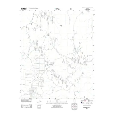
2012 Map of Fitzgerald Hill
USGS Topo · Published 2012About this map
Santa Cruz Quarry and Antelope Quarries define the industrial footprint of this Coconino County landscape during the early 21st century. The map reveals an intricate network of residential streets and access roads, including W Grand Blvd and Loma Linda Rd, which transition into a more open landscape dominated by ranching infrastructure. Numerous livestock tanks, such as Blue Cow Tank, Rock House Tank, and Steiger Tank, are scattered across the terrain, indicating the ongoing importance of water management in this arid environment. Significant topographical markers like Fitzgerald Hill, Ferno Mesa, and Paradise Ridge provide natural landmarks for the area. The presence of Double A Siding and Cucamonga Junction highlights the intersection of rail and road transport that facilitates the movement of resources and residents through the high desert.
Find a feature on this map
66 named features on this map. Tap any name to fly to it.
Don’t see what you’re looking for? This feature index may not catch every label — zoom into the map to look around manually.
Map Details
Editions of this 2012 Fitzgerald Hill Map
This is the sole edition of this map. No revisions or reprints were ever made.
Other maps of this area

1886 · Chino
USGS Topo · 1:250,000

1891 · Chino
USGS Topo · 1:250,000

1922 · Williams
USGS Topo · 1:125,000

1947 · Ash Fork
USGS Topo · 1:62,500

1947 · Picacho Butte
USGS Topo · 1:62,500

1948 · Ash Fork
USGS Topo · 1:63,360

1948 · Williams
USGS Topo · 1:250,000

1948 · Picacho Butte
USGS Topo · 1:63,360

1949 · Ash Fork
USGS Topo · 1:62,500

1950 · Picacho Butte
USGS Topo · 1:62,500