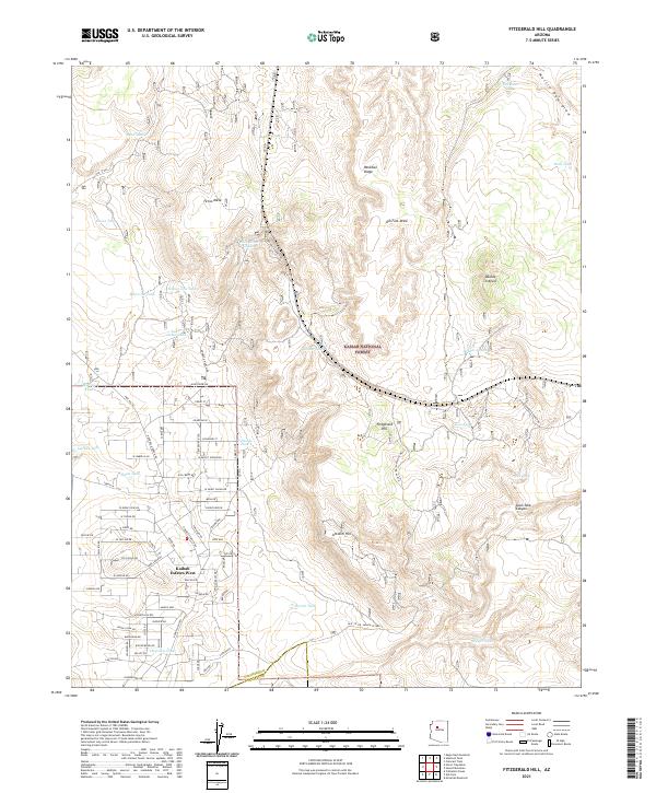
2021 Map of Fitzgerald Hill
USGS Topo · Published 2021About this map
Kaibab National Forest dominates this landscape, showing a high-country transition where the residential development of Kaibab Estates West meets the open range. The settlement pattern here is characterized by a dense grid of residential roads like Grand Blvd and W Isabella Ln that abruptly stop at the forest boundary. This interface highlights the 21st-century expansion of rural subdivisions in Northern Arizona, where traditional ranching infrastructure still dots the land. Numerous water catchments, such as Punk Tank and Steiger Tank, serve as vital landmarks across the terrain, while topographical features like Fitzgerald Hill and Paradise Ridge provide natural landmarks for the area. The presence of Quarry Rd suggests the local extraction industry that often supports such remote settlements, while the winding course of Juan Tank Canyon and Ash Fork Draw illustrate the complex drainage systems that define the region's geography.
Find a feature on this map
72 named features on this map. Tap any name to fly to it.
Don’t see what you’re looking for? This feature index may not catch every label — zoom into the map to look around manually.
Map Details
Editions of this 2021 Fitzgerald Hill Map
This is the sole edition of this map. No revisions or reprints were ever made.
Other maps of this area

1886 · Chino
USGS Topo · 1:250,000

1891 · Chino
USGS Topo · 1:250,000

1922 · Williams
USGS Topo · 1:125,000

1947 · Ash Fork
USGS Topo · 1:62,500

1947 · Picacho Butte
USGS Topo · 1:62,500

1948 · Ash Fork
USGS Topo · 1:63,360

1948 · Williams
USGS Topo · 1:250,000

1948 · Picacho Butte
USGS Topo · 1:63,360

1949 · Ash Fork
USGS Topo · 1:62,500

1950 · Picacho Butte
USGS Topo · 1:62,500