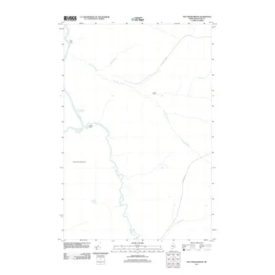
2011 Map of Five Finger Brook
USGS Topo · Published 2011About this map
The Allagash River corridor in northern Maine defines this 2011 survey, showing a landscape shaped by remote waterways and timber management infrastructure. The topography is dominated by Round Pond Mountain and the complex drainage systems of Five Finger Brook and Musquacook Stream. This map illustrates the vital role of specific local landmarks in navigating this interior wilderness, from geological markers like Rosies Rock to remote outposts such as Five Finger Camp and Rideout Cabin. The presence of Michaud Farm Rd and W Side Echo Lake Rd reflects the specialized road network used for forest access and recreation. Researchers can trace the winding course of the Musquacook Deadwater, a distinct hydrological feature typical of the region's slower-moving river segments.
Find a feature on this map
12 named features on this map. Tap any name to fly to it.
Don’t see what you’re looking for? This feature index may not catch every label — zoom into the map to look around manually.
Map Details
Editions of this 2011 Five Finger Brook Map
This is the sole edition of this map. No revisions or reprints were ever made.
Other maps of this area

1932 · Umsaskis Lake
USGS Topo · 1:48,000

1932 · Musquacook Lakes
USGS Topo · 1:48,000

1932 · Allagash Falls
USGS Topo · 1:48,000

1935 · Umsaskis Lake
USGS Topo · 1:62,500

1935 · Musquacook Lakes
USGS Topo · 1:62,500

1935 · Allagash Falls
USGS Topo · 1:62,500

1954 · Presque Isle
USGS Topo · 1:250,000

1955 · Round Pond
USGS Topo · 1:62,500

1956 · Allagash Falls
USGS Topo · 1:50,000

1958 · Presque Isle
USGS Topo · 1:250,000