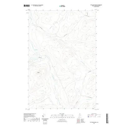
2021 Map of Five Finger Brook
USGS Topo · Published 2021About this map
The Allagash River defines the western edge of this northern Maine landscape, winding past the Musquacook Deadwater and Moose Bogan. This area is characterized by a dense network of waterways and timber-related infrastructure, where Musquacook Stream and Five Finger Brook converge near the prominent landmark of Rosies Rock. The topography is dominated by peaks like Round Pond Mtn, rising above a system of remote logging routes including W Side Echo Lake Rd and Twenty Mile Brook Rd. These roads provide the primary access through the thick forest, connecting various drainages such as Sinclair Brook and Rocky Brook. The map captures a quintessential North Woods environment where the economy and geography are centered on the river's path and the ridgelines that separate these remote watersheds.
Find a feature on this map
12 named features on this map. Tap any name to fly to it.
Don’t see what you’re looking for? This feature index may not catch every label — zoom into the map to look around manually.
Map Details
Editions of this 2021 Five Finger Brook Map
This is the sole edition of this map. No revisions or reprints were ever made.
Other maps of this area

1932 · Umsaskis Lake
USGS Topo · 1:48,000

1932 · Musquacook Lakes
USGS Topo · 1:48,000

1932 · Allagash Falls
USGS Topo · 1:48,000

1935 · Umsaskis Lake
USGS Topo · 1:62,500

1935 · Musquacook Lakes
USGS Topo · 1:62,500

1935 · Allagash Falls
USGS Topo · 1:62,500

1954 · Presque Isle
USGS Topo · 1:250,000

1955 · Round Pond
USGS Topo · 1:62,500

1956 · Allagash Falls
USGS Topo · 1:50,000

1958 · Presque Isle
USGS Topo · 1:250,000